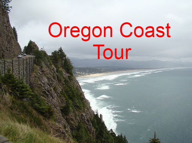
CITY TOUR
(WITH PHIL) and each stop named.
Welcome.
Welcome, fellow stump Towners.
Welcome to My Chauffeur tours.
1ST...We'll start off, with what we will be seeing, and a little about Portland History:
WE HIGHLY RECOMMEND, THAT YOU FOLLOW ALONG WITH PICTURES.
Let Phil know if you want to follow along with pictures.
He will send them via, Air drop, to your iPhone.
Be sure to turn on Air Drop on your iPhone.
To view the pictures. Go to, settings, general, air drop. And turn on.
But for Android phones.
YOU CAN FOLLOW ALONG WITH PICTURES AS WELL.
Go to, tour portland, dot com, forward slash, pictures 3.
The code is, 8 9 0 1.
Once again, that's.
Tour portland, dot com, forward slash, pictures 3.
The code is, 8 9 0 1.
I'LL PAUSE, TO USE AIRDROP, AND SO THAT EVERYONE CAN FIND THE PICTURES.
PAUSE
PAUSE
PAUSE
OK
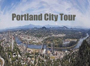
See first Picture, downtown Map of the different AREAS we may see.
Our standard sights are on this map, but we may exclude areas, or include additional areas or sights, on request.
For example, on the walking tour, only 1 or more of the circled areas, on the right, are included.
And on the driving tour, we typically include, all of the circled areas.
Downtown, the cultural district, Pearl District, the waterfront, and old town Portland, are along the Willamette River.
The Pittock Mansion, Washington Park, the Japanese Garden, and the Rose Garden, are to the left, in the map.
It goes by many names.
The Rose City.
Bridge City.
Portlandia.
Rip City.
Bike town
puddle town.
Soccer City USA.
And Stump town.
But for more than 175 years, it's been known by one name: Portland.
Portland began as a riverside clearing, where Multnomah Indians of the Chinook Tribe, occasionally camped about 6 blocks from here, at the river. It was called, The Clearing.
In 1843, when entrepreneur Asa Lovejoy, stopped for lunch in that clearing, with a drifter named William Overton, traveling between Fort Vancouver and Oregon City, offered 25 cents, to the provisional government, for the 640-acre, The Clearing.
They marked the site with tomahawk blazes on a tree.
It was the demand for beaver to feed the fashion of the day, that first brought these European traders to Oregon.
Stove top hats (or Top hats), were usually made of beaver pelts. It seems only a change in style saved the Beaver from extinction.
PICTURE AVAILABLE.
See picture #2, Tall-crowned hats usually made of Beaver pelt
Welcome, fellow stump Towners.
Welcome to My Chauffeur tours.
1ST...We'll start off, with what we will be seeing, and a little about Portland History:
WE HIGHLY RECOMMEND, THAT YOU FOLLOW ALONG WITH PICTURES.
Let Phil know if you want to follow along with pictures.
He will send them via, Air drop, to your iPhone.
Be sure to turn on Air Drop on your iPhone.
To view the pictures. Go to, settings, general, air drop. And turn on.
But for Android phones.
YOU CAN FOLLOW ALONG WITH PICTURES AS WELL.
Go to, tour portland, dot com, forward slash, pictures 3.
The code is, 8 9 0 1.
Once again, that's.
Tour portland, dot com, forward slash, pictures 3.
The code is, 8 9 0 1.
I'LL PAUSE, TO USE AIRDROP, AND SO THAT EVERYONE CAN FIND THE PICTURES.
PAUSE
PAUSE
PAUSE
OK
See first Picture, downtown Map of the different AREAS we may see.
Our standard sights are on this map, but we may exclude areas, or include additional areas or sights, on request.
For example, on the walking tour, only 1 or more of the circled areas, on the right, are included.
And on the driving tour, we typically include, all of the circled areas.
Downtown, the cultural district, Pearl District, the waterfront, and old town Portland, are along the Willamette River.
The Pittock Mansion, Washington Park, the Japanese Garden, and the Rose Garden, are to the left, in the map.
It goes by many names.
The Rose City.
Bridge City.
Portlandia.
Rip City.
Bike town
puddle town.
Soccer City USA.
And Stump town.
But for more than 175 years, it's been known by one name: Portland.
Portland began as a riverside clearing, where Multnomah Indians of the Chinook Tribe, occasionally camped about 6 blocks from here, at the river. It was called, The Clearing.
In 1843, when entrepreneur Asa Lovejoy, stopped for lunch in that clearing, with a drifter named William Overton, traveling between Fort Vancouver and Oregon City, offered 25 cents, to the provisional government, for the 640-acre, The Clearing.
They marked the site with tomahawk blazes on a tree.
It was the demand for beaver to feed the fashion of the day, that first brought these European traders to Oregon.
Stove top hats (or Top hats), were usually made of beaver pelts. It seems only a change in style saved the Beaver from extinction.
PICTURE AVAILABLE.
See picture #2, Tall-crowned hats usually made of Beaver pelt
Overton, a drifter (who borrowed the 25 cent filing fee from Lovejoy, in exchange for half his claim), drifted away by eighteen forty four, selling his half to Francis Pettygrove for fifty dollars. After "flippin a copper", Pettygrove named the new townsite Portland in 1845, but not until after, like a Deadwood crime boss, spoke of settling a claim dispute by his pistols.
But let's give credit where credit's due. It was William Overton, the man from Missouri, who is 25% Creek Indian, and a member of the eighteen forty one Bidwell party, (the 1st on the Oregon Trail going to California), splintered off to Oregon, and had the idea, of the Portland town site.
Unlike the Oregon City location, where the provisional government was located, and the location of the end of the Oregon Trail, the densely wooded site of Portland, with 200 foot tall, seven foot in diameter, Black Cotton Wood trees, included a harbor, deep enough for ocean going ships, and was located on the Willamette River, below the treacherous Clackamas rapids and Willamette Falls.
At first ridiculed as Stumptown, it surpassed Oregon City as a port within 6 years.
Willamette Falls, worth mentioning in its own right, is the second biggest falls in the United States by volume, after Niagara Falls, and is fifteen hundred feet across and 4 stories high. Cultures have gathered around that falls for millennium figuring out how best to utilize it.
The willamette river was named after it.
It's where the future began.
Indians have been fishing for Salmon there at the base of the falls for thousands of years. The Europeans settlers built saw mills there and made a town. And in 1889, the first long distance electrical transmission line in the history of the world, strung from Willamette Falls to Portland, a distance of 17 miles, lighting up Portland, and electric trolley tracks within 2 years.
...
Geology:
Now a little about the geology.
Those falls were formed by geologic chance. It's a story of 2 great floods.
One of the greatest volcanic eruptions on the face of the earth, starting about 17 million years ago, the Columbia River Basalt Floods, traveling some 400 miles from North Eastern Oregon and western Idaho, originating from the Yellowstone Super Volcano hot spot.
Then later, The largest floods on earth traveled right over Portland and topped it with 400 feet of water.
FOLLOW ALONG WITH PICTURES.
See Pictures, Ice Age Floods #6
The largest floods on earth traveled right over Portland and topped it with 400 feet of water.
See Pictures, Ice Age Floods #6
A total of 8 ice age floods pictures.
These events are known as the 'Missoula Floods', or Ice Age Floods, occurring at the end of the last ice age, sometime around 14 to 18 thousand years ago.
The Missoula Floods, ripped off cliff faces in the Columbia and Willamette Rivers, scoured the 40 foot Willamette Falls plunge, and the 80 foot Celilo Falls, created "all" the other waterfalls in the Columbia Basin, and the, largest Falls on Earth, Dry Falls in Eastern Washington state.
See Pictures,
See Pictures, Ice Age Floods #1, 3, 4 and #5.
A total of 8 pictures.
Coffee, Coffee, Coffee.
Good coffee near here.
CLICK HERE FOR.
DT Coffee Shop MAP - DT Coffee Crawl
OUR NEXT STOP IS PIONEER COURTHOUSE SQUARE, OR, IS TO BE ANNOUNCED.
Does anyone have any questions?
But let's give credit where credit's due. It was William Overton, the man from Missouri, who is 25% Creek Indian, and a member of the eighteen forty one Bidwell party, (the 1st on the Oregon Trail going to California), splintered off to Oregon, and had the idea, of the Portland town site.
Unlike the Oregon City location, where the provisional government was located, and the location of the end of the Oregon Trail, the densely wooded site of Portland, with 200 foot tall, seven foot in diameter, Black Cotton Wood trees, included a harbor, deep enough for ocean going ships, and was located on the Willamette River, below the treacherous Clackamas rapids and Willamette Falls.
At first ridiculed as Stumptown, it surpassed Oregon City as a port within 6 years.
Willamette Falls, worth mentioning in its own right, is the second biggest falls in the United States by volume, after Niagara Falls, and is fifteen hundred feet across and 4 stories high. Cultures have gathered around that falls for millennium figuring out how best to utilize it.
The willamette river was named after it.
It's where the future began.
Indians have been fishing for Salmon there at the base of the falls for thousands of years. The Europeans settlers built saw mills there and made a town. And in 1889, the first long distance electrical transmission line in the history of the world, strung from Willamette Falls to Portland, a distance of 17 miles, lighting up Portland, and electric trolley tracks within 2 years.
...
Geology:
Now a little about the geology.
Those falls were formed by geologic chance. It's a story of 2 great floods.
One of the greatest volcanic eruptions on the face of the earth, starting about 17 million years ago, the Columbia River Basalt Floods, traveling some 400 miles from North Eastern Oregon and western Idaho, originating from the Yellowstone Super Volcano hot spot.
Then later, The largest floods on earth traveled right over Portland and topped it with 400 feet of water.
FOLLOW ALONG WITH PICTURES.
See Pictures, Ice Age Floods #6
The largest floods on earth traveled right over Portland and topped it with 400 feet of water.
See Pictures, Ice Age Floods #6
A total of 8 ice age floods pictures.
These events are known as the 'Missoula Floods', or Ice Age Floods, occurring at the end of the last ice age, sometime around 14 to 18 thousand years ago.
The Missoula Floods, ripped off cliff faces in the Columbia and Willamette Rivers, scoured the 40 foot Willamette Falls plunge, and the 80 foot Celilo Falls, created "all" the other waterfalls in the Columbia Basin, and the, largest Falls on Earth, Dry Falls in Eastern Washington state.
See Pictures,
See Pictures, Ice Age Floods #1, 3, 4 and #5.
A total of 8 pictures.
Coffee, Coffee, Coffee.
Good coffee near here.
- Good Coffee - At Alder between 8th and 9th, across from Rich's Cigars
- Case Study Coffee, at Yamhill and 10th
CLICK HERE FOR.
DT Coffee Shop MAP - DT Coffee Crawl
OUR NEXT STOP IS PIONEER COURTHOUSE SQUARE, OR, IS TO BE ANNOUNCED.
Does anyone have any questions?