Map
See pictures. See map. Our Route Today
See map. There is also a map hand out, in the bus. Check it out!
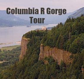
The Columbia River Gorge.. An Amazing Place... And A Gorge Country Intro.
We'll start our journey at the Quick Sand River, also known as, Sandy River, just ahead of us. I'll tell you when we are crossing over.
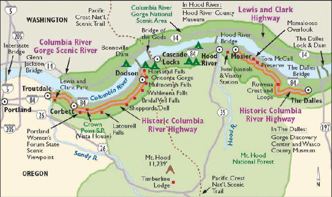
But first, we'll look at our route map.
On this map, you will see the Quick sand River, or Sandy River, on the left, just below Troutdale. More about that, in a moment.
You will notice, that the Sandy river runs all the way from near the top of Mount Hood, to Troutdale.
Our route, will follow the old road, between Corbett, on the left, and, Horse tail Falls, in the middle, going west to east.
We will stop, and get out, on all, most, or many of the stops between Corbett, and Horsetail Falls, depending on your tour length, and what we have time for.
Sometimes, we add sights east of Horse Tail Falls.
Does anyone have any questions?
The Columbia River Gorge.. An Amazing Place... And A Gorge Country Intro.
We'll start our journey at the Quick Sand River, also known as, Sandy River, just ahead of us. I'll tell you when we are crossing over.
But first, we'll look at our route map.
On this map, you will see the Quick sand River, or Sandy River, on the left, just below Troutdale. More about that, in a moment.
You will notice, that the Sandy river runs all the way from near the top of Mount Hood, to Troutdale.
Our route, will follow the old road, between Corbett, on the left, and, Horse tail Falls, in the middle, going west to east.
We will stop, and get out, on all, most, or many of the stops between Corbett, and Horsetail Falls, depending on your tour length, and what we have time for.
Sometimes, we add sights east of Horse Tail Falls.
Does anyone have any questions?